For years, we have been told that sea level is rising at a steady, predictable pace. We built our sea walls and our future maps every year based on a few millimeters of change. But a massive update to our global data has revealed a frightening reality in 2026: the coastline is shrinking much faster than we ever predicted. The old Sea-Level Math was missing a vital element that is now coming to light.
It turns out that we weren’t just measuring the water rising; we were forgetting that the land is also sinking. This Double Squeeze makes our beaches disappear at double the speed. New satellite scans have identified hot spots where ocean waters are moving inland by feet, not inches, every year. This isn’t just about the far future, it is about the houses and roads we have right now. But what exactly did the old maths get wrong?
The Hidden Sinking of the Cities
The old models assumed the ground was a solid, unmoving platform. But our giant cities are incredibly heavy. The weight of millions of tons of concrete is actually pushing the land down into the soft earth. This process, called Subsidence, is happening in almost every major coastal city from New York to Shanghai. When the land sinks and the water rises, the impact is multiplied. We are essentially walking down an elevator while it is moving up. But there is a second, even weirder factor involving the Earth’s gravity.
The Gravitational Pull of the Ice

This sounds like science fiction, but it is pure physics. Giant ice sheets in the Arctic are so heavy that they actually have their own gravitational pull. They pull the ocean water toward them. As the ice melts and becomes lighter, that gravitational pull weakens. The water that was being held at the poles is now rushing back toward the equator. This is causing sea levels to rise much faster in tropical areas than in the north. The Math was wrong because we didn’t realize how much the ice was holding the water back. But wait until you see what is happening to the ocean floor.
The Bending of the Ocean Floor
As the glaciers melt, a massive amount of water weight is being added to the ocean. This weight is so heavy that it is actually bending the ocean floor downward. This Ocean Deformation means the bowl that holds the water is changing shape. It makes it almost impossible to get an accurate reading using old-fashioned tide gauges. We had to wait for 2026 satellite technology to see the Big Picture. We are looking at a planet that is literally reshaping itself under the weight of the water. But can we build our way out of this?
The Failure of the Old Sea Walls
Because our math was wrong, our sea walls are too short. Many of the multi-billion-dollar projects built in the last decade are already being overwhelmed by high tides. The 100-Year Storms are now happening every five years. We are realizing that fighting the water with concrete is a losing battle. The new strategy is Living Shorelines, using mangroves and oyster reefs to absorb the energy of the water. We have to learn to soften the blow instead of blocking it. But is it too late for some of our favorite vacation spots?
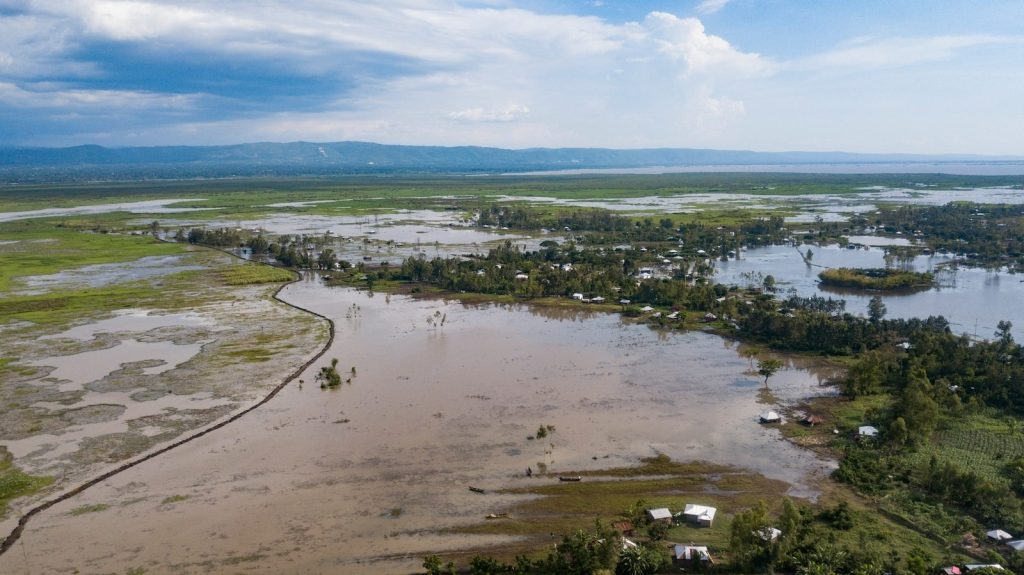
The Disappearing Beach Paradox

Have you noticed your favorite beach getting smaller every year? It isn’t just your imagination. The new math shows that we are losing sand volume at a record pace. The combination of rising water and sinking land is creating a Current Vortex that pulls sand away from the coast and into the deep ocean. We are spending millions to pump sand back onto the beaches, but it only lasts for a few months. We are in a race against a tide that never sleeps. But what does this mean for the value of your home?
The Great Real Estate Reset
As the new Sea-Level Math becomes public, the real estate market is going through a massive reset. Insurance companies are using the 2026 data to change their rates, making some coastal homes uninsurable. We are seeing a Migration Inland as people move away from the high-risk zones. It is the beginning of a new map of the world. The Blue Zone on the map is moving, and we have to move with it. But there is a hopeful side to this discovery.
Turning Data into a New Future

Now that we have the correct math, we can plan for the real future. We are designing Seaborne Cities and Amphibious Buildings that can rise and fall with the water. We are moving from a world of fixed boundaries to a world of fluid solutions. The 2026 reveal served as a wake-up call, but it also served as a blueprint for survival. We finally look at the planet with clear eyes. But are you ready for the next discovery that is already hitting the headlines?
The Countdown to a Resilient Planet:

We are counting down to a future that looks a lot different from the past. This new math isn’t just about bad news, it’s about having the truth so we can build a better world. We are moving toward a stronger resilient planet, and it starts with understanding the ground on which we are. The next chapter is up to us!
Featured Image:Photo by Bobby Youstra on Unsplash
Leave a Reply